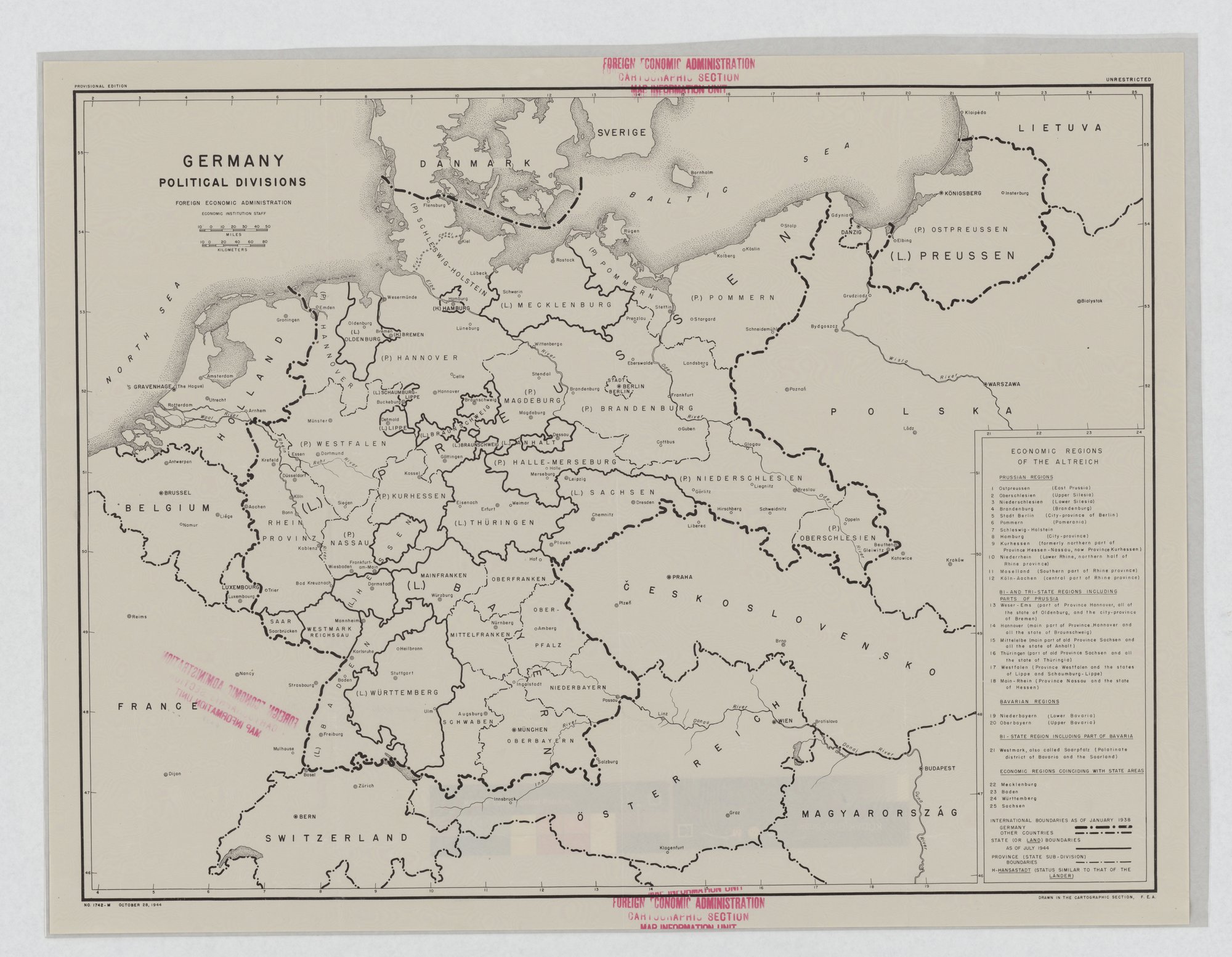
Germany: Political Divisions is map No. 1742-M of October 28, 1944, drawn in the Cartographic Section of the Foreign Economic Administration. It shows German state boundaries as of July 1944, international boundaries as of January 1938, and a key to 25 economic regions (NAID 514352).
A working map, marked unrestricted
This is a black-and-white reference map of Germany, and it reads like one. Lines mark the states and provinces, a numbered key divides the country into economic regions, and the sheet carries the office's name, a map number and a date. The sheet calls itself a provisional edition and marks itself "UNRESTRICTED".
GERMANY
POLITICAL DIVISIONS
FOREIGN ECONOMIC ADMINISTRATION
ECONOMIC INSTITUTION STAFF
PROVISIONAL EDITION
UNRESTRICTED
ECONOMIC REGIONS OF THE ALTREICH
[...]
INTERNATIONAL BOUNDARIES AS OF JANUARY 1938: GERMANY / OTHER COUNTRIES
STATE (OR LAND) BOUNDARIES AS OF JULY 1944
[...]
NO. 1742-M OCTOBER 28, 1944
DRAWN IN THE CARTOGRAPHIC SECTION, F.E.A.
The Foreign Economic Administration's cartographers
The map names the Foreign Economic Administration, its Economic Institution Staff, and the Cartographic Section that drew it. A stamp adds the section's Map Information Unit. The key numbers 25 economic regions, grouped as Prussian regions, regions spanning Prussia and other states, Bavarian regions, a region shared by Bavaria and the Saarland, and regions that match a single state. The National Archives keeps it with the World War II posters in Record Group 44. FRAME files the purpose as "Warn or inform" and the audience as "Domestic public".
Is a reference map propaganda?
Barely, and the archive says so. FRAME tags card stacking but calls the technique faint, pointing to two choices as framing: international borders drawn as of January 1938, and German-language place names. Among the country labels the transcription lists are ÖSTERREICH and ČESKOSLOVENSKO.
The useful point for a reader is how plain the sheet is. It has no enemy face, no slogan and no request. It is a government office laying out the territory it was studying, dated, numbered and labeled provisional.
A very different map on this site is Alcoa's 1943 Global Map for Global War and Global Peace, a corporate wall chart whose copy credits Alcoa Aluminum for the strength of U.S. bombers. The posters aimed at Hitler's government are on the anti-Nazi propaganda hub, and the Roosevelt administration essay describes the wartime offices.
Sources
- FRAME object record, Germany: Political Divisions, 1944. Foreign Economic Administration, Economic Institution Staff, Cartographic Section. Rights as recorded: public domain (U.S. government work).
- U.S. National Archives and Records Administration, Record Group 44, World War II Posters, 44-PA-858, NAID 514352, retrieved by the archive 4 October 2026.